
Only 3 days before Round-1 of the World Orienteering Cup kicks off in Olten (Switzerland). We can expect fast and tricky orienteering with a very high-level organization, as always Matthias & Simone Niggli (and the Swiss Orienteering Federation) are leading the event.
Today we suggest the second simulation leg on the old map of Olten (2014). Some extra fences make the routechoices more difficult, and many options are open. Can you find the optimal route? Draw it by clicking the link below.

SPOILER ALERT!!!
If you haven’t drawn your route yet, do not keep scrolling down!!!
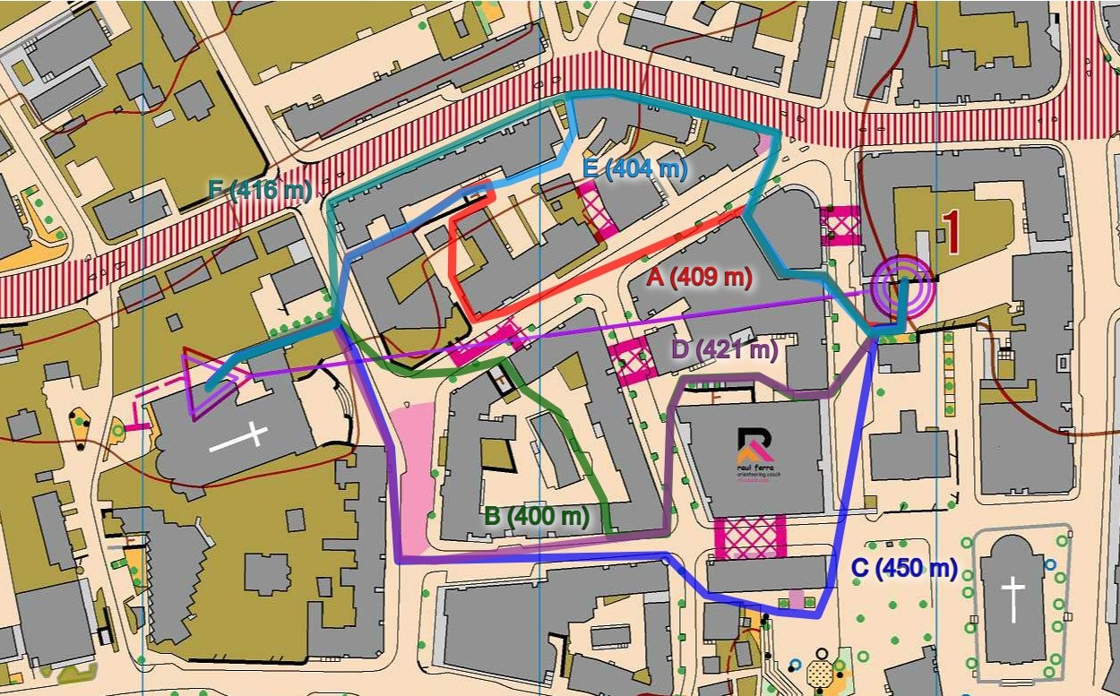
In this case, we have also pretty similar lengths on the different route choices (except for the “C” option, with 450m, which is longer). The “B” option (400m) is the shortest, but only a few meters than the “E” option (404m), and the “A” option (409m). “D” option (421m) and “F” option (416m) are still ok choices.
Being fast in picking up your route, and executing it precisely, will be the key factors again as the differences are not too big (except if you pick the longest one!). During the execution, it is very important to stay alert and not hesitate on the turns… or the canopy entrances! (in the picture below, you can see the entrance of the canopy on the Northwest of the control, used by routes A, E, & F. Easy to miss it if you are not sharp enough!)

Discover more from RF-COACH
Subscribe to get the latest posts sent to your email.
