The Junior European Championships mark the final international battle of the 2025 season. A last chance for the best juniors in Europe to measure themselves against each other before the long winter of preparation begins again. The program is a classic trilogy: Sprint, Long Distance, and Relay. And if one discipline truly embodies the grit, heart, and spirit of junior orienteering, it is the long distance.
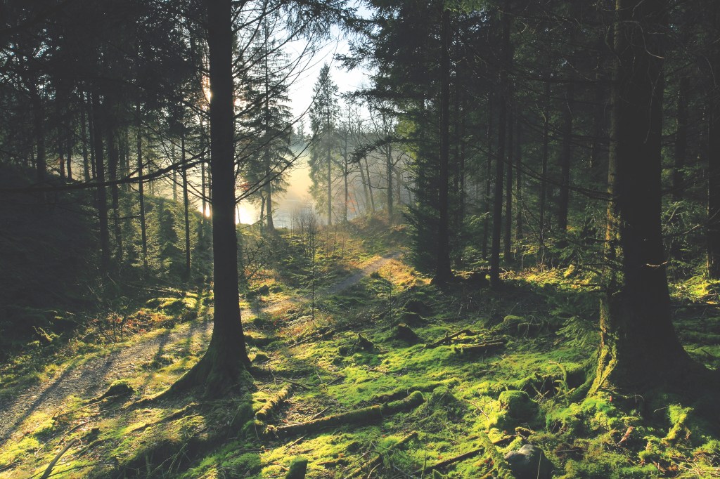
This year’s long distance unfolds in the mythical Loch Ard Forest, a name that already sparks imagination. Think mist-covered hills, dense spruce stands, hidden marshes, and the echoes of bagpipes in the wind. It is a landscape worthy of Braveheart: raw, wild, and unforgiving. To master it, runners will need not only strong legs and lungs, but also sharp eyes, a calm head, and the courage to commit to their chosen line.
🗺️ The Challenge of Loch Ard
The terrain is both physically and technically demanding—a true test of all long distance orienteering skills. Most of the area is spruce forest, but the variety is immense:
- White forest offers visibility and decent runnability.
- Light and medium green hide low branches that slash visibility and slow your stride.
- Dark green is rhododendron or fallen trees, sometimes nearly impassable. Best avoided.
- Green stripes mark bracken, brambles, or windthrow. Crossing them is possible, but it will cost energy and time.
- Marshes range from runnable to treacherously deep.
- Extraction lanes and rides appear here and there. Tempting lines of speed, but not always aligned with your optimal direction.
In short, this is not a forest where straight lines always pay off. Each decision to deviate from the line must be weighed carefully: more distance versus less climb, safety versus risk, clarity versus hesitation.
🎯 Simulated Route Choice
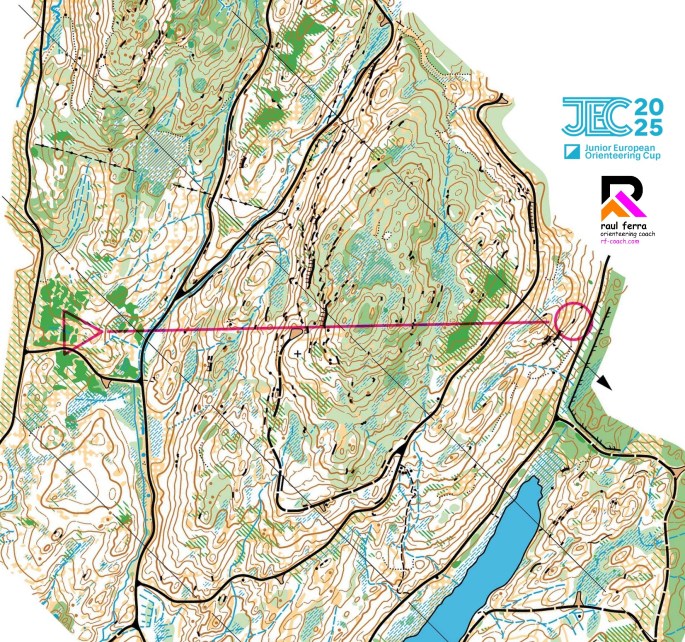
To bring this challenge to life, we’ve designed a simulated leg that mirrors what the athletes will face in Loch Ard.
📍 Length in the straight line: 1020 m
The leg crosses one of the main hills of the mapped area. On paper, it looks simple: point A to point B. In reality, the choices open wide. How much climb do you accept? Do you plunge through steep slopes and dense forest, or swing wider to use paths and gentler lines?
This is the essence of long distance: balancing speed, terrain, and energy over the course of the race.
➡️ Your task:
Take a close look at the map and imagine yourself on the start line.
- Would you go straight, pushing over the steepest part of the hill for the shortest line?
- Would you curve wider, using tracks and runnable forest to keep momentum?
- Or would you gamble with an in-between solution, threading the cleanest micro-passages and trusting your compass to keep the line?
Draw your route, test your ideas, and share your thoughts. As always, you can use the WebRoute tool on World of O to sketch and compare.
🧠 Final Words
The JEC long distance will not only crown champions. It will test who can keep fighting when the forest pushes back, when branches scratch your face, when your compass wavers in vague green, when the hill never seems to end.
This is where juniors turn into future elites. This is where lessons are learned, the hard way.
Loch Ard awaits. Are you ready?
SPOILER ALERT!!!
If you haven’t drawn your route yet, do not keep scrolling down!!!
The analysis of the routes is posted just below!!!
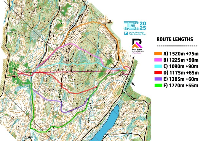
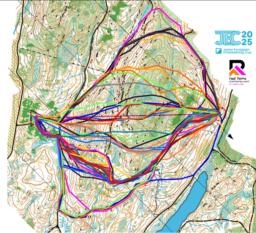
Six clearly different alternatives appear across the slope, each with unique demands and trade-offs. From straight, technical forest running to conservative track-based options, this leg tests both the physical and mental qualities of every athlete.
Let’s take a closer look at the alternatives.
Option A (1520 m / +75 m)
The Highway Left
This route swings far left, using nearly 80% track running and only a short, simple forest connection. It is one of the easiest to execute and allows for almost uninterrupted maximum running speed. The price? Roughly 500 extra metres compared to the direct line.
➡️ Safe, straightforward, and fast underfoot, but at a significant physical cost.
✅ A smart option for athletes who want to minimise risk and keep full control of execution.
Option B (1225 m / +90 m)
The Mixed Left
Also on the left side, but cutting more directly than A. This option includes an early steep slope and sections of denser forest where runnability is lower and visibility patchy. It represents an “in-between” solution: shorter than A, but technically and physically more demanding.
➡️ A compromise option: viable, but only efficient if handled with precision.
⚠️ Demands careful execution; otherwise, the extra climb and vegetation slowdowns may cost valuable seconds.
Option C (1090 m / +90 m)
The Braveheart Line
The straightest and boldest choice. It cuts directly over the colline, demanding aggressive navigation through forest almost the entire way and tackling one of the steepest climbs. Success here depends entirely on confidence in compass, direction, and micro-route execution.
➡️ Shortest in distance, but mentally and physically brutal.
❌ Only recommended for technically strong and fearless runners. Any hesitation will be heavily punished.
Option D (1175 m / +65 m)
The Balanced Right
This right-hand option offers a good trade-off: moderate distance, reduced climb compared to B and C, and progress along reasonably clear forest lines. It avoids the extremes of both A and C, striking a balance between efficiency and safety.
➡️ A versatile choice that keeps risk under control without sacrificing too much time.
✅ Suitable for many runners, likely one of the most “universal” options.
Option E (1385 m / +60 m)
The Right Runner’s Track
Even further to the right, this alternative links up with a longer stretch of path and track. While not as extreme as F, it allows long phases of high-speed running with simple navigation. The final approach to the control is straightforward, though the extra distance is noticeable.
➡️ Easier to execute at race pace, but demands raw physical strength to compensate for the added metres.
⚠️ An “intermediate long” option. Viable, but not ideal for those lacking endurance.
Option F (1770 m / +55 m)
The Marathon Detour
The most extreme right-hand choice: nearly the entire leg is on wide, runnable track. It minimises climb and simplifies navigation almost to the point of triviality. The drawback is obvious: over 700 m extra compared to the red line.
➡️ Physically simple, mentally relaxing, but perhaps too costly for top-level efficiency.
✅ Still, for athletes outside the very top positions, especially in a long distance, this can be a clever way to secure a clean leg with no major risks.
🏁 Final Thoughts
This leg is the perfect example of long distance strategy in Loch Ard: no single “perfect” option, but rather a spectrum of choices depending on the runner’s profile, physical condition, and risk tolerance. The direct line (C) is bold but punishing. The extreme detours (A and F) simplify execution but demand extra energy. The middle-ground solutions (D and E) may well prove to be the most effective for the majority of athletes.
As always in long distance orienteering, it is not only about finding the best route, it is about making the smartest decision for your race as a whole. Sometimes, the conservative option is the true winning one.
Discover more from Orienteering Coach
Subscribe to get the latest posts sent to your email.
