
This Saturday, one of the most crucial steps in the journey to the World Orienteering Championships 2025 will take place: the WOC test races in Kuopio. As part of our new series, Route to WOC25 Kuopio, we’ll be diving into some of the terrain’s most demanding route choice challenges.
Let’s kick things off with a forest leg simulation inspired by what the athletes will face in Puijo. This is your chance to draw your route, reflect on the strategic demands, and prepare like the elite.
🗺️ The Terrain: Puijo in Focus
Puijo is a distinctive hill in the heart of Kuopio, and a true test of both technical and physical orienteering. The terrain blends:
- Small, detailed sections with boulders, small cliffs, and steep slopes.
- Open forest areas, fast but deceptively tricky for navigation.
- A dense track network that offers tempting route choices.
- Mixed vegetation, mainly deciduous, pine, and spruce.
- Fallen trees and elevation that can break your rhythm and slow your legs.
In short: fast decisions, shifting visibility, physical climbing, and the need for high-precision map reading—especially when transitioning between very different types of terrain.
📍 Simulated LEG from the WOC Test Race
Here’s the first simulation in this series which presents exactly the type of leg where winning or losing seconds will depend not just on your physical strength, but on your ability to read terrain and plan ahead.
➡️ Your task:
Take a close look at the map below. Draw your route. Think not only about the shortest path, but about runability, climb, terrain type, and attack strategy. What would you do in race conditions?
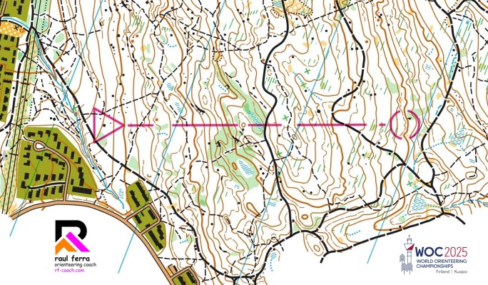
🧠 Think About…
- Where are the most runnable areas—and where will fallen trees or undergrowth slow you down?
- How steep is each possible option? Is it worth a longer flat route?
- Can you use paths or clearings to simplify the navigation, or would that risk overshooting?
- How would your mental focus shift between detail-rich and open areas?
📆 Stay tuned for more simulations, route challenges, and analysis all the way to WOC25.
The forest of Finland is calling. Will you be ready?
SPOILER ALERT!!!
If you haven’t drawn your route yet, do not keep scrolling down!!!
The analysis of the routes is posted just below!!!
After presenting the simulation leg inspired by the upcoming WOC test races in Puijo, it’s time to dive into the strategic analysis. This leg isn’t just about finding a line between two circles—it’s a layered decision-making challenge where multiple variables must be weighed carefully.
This leg presents several important variables to consider before deciding on the best execution: route length, climb, surface type (wide track, small path, forest…), and also overall race strategy (physical condition, technical approach, moments to plan ahead…).
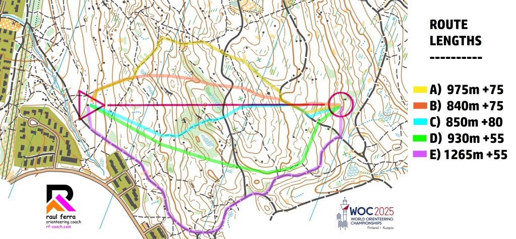
Based on that, we can identify five main route choices (with many small micro-variants). Here’s the breakdown:
Option A (975m / +75m)
Left-hand route. Almost the entire climb on small paths and an easy descent through the reentrant to the track. Very safe but quite long.
➡️ Smooth and under control, but likely too long.
Option B (840m / +75m)
Also on the left, but more direct. Same climb as A but 135m shorter. The uphill is mostly through the forest, so ground conditions are key.
➡️ Good choice if the forest is runnable and you’re physically strong.
Option C (850m / +80m)
Fairly straight, slightly to the right. First part through the forest, then on a small path for the steepest section.
➡️ A solid mix of directness and control.
Option D (930m / +55m)
Further right, avoiding some climb. Entirely through forest, making navigation more demanding.
➡️ Tempting in terms of climb, but technically risky.
Option E (1265m / +55m)
By far the longest, but entirely on the wide, fast track and with the least climb.
➡️ Great for high-speed runners looking to minimize physical load.
So, what’s the best route?
As usual in orienteering… it depends 😄 There’s no single “correct” choice—several factors influence the best option: physical condition, running style, confidence with navigation, forest runnability, and race context. That said, here’s my take:
♂️ Men: Option C looks like the overall best. It offers a good balance between directness and control, and allows decent running speed without taking too much risk. Option B is slightly shorter and could also be fast, but only if the forest is clean and you’re physically ready for a tough uphill. Option E (around) is surprisingly competitive: even though it’s much longer, the wide track and minimal climb might compensate—especially for those who can maintain high speed. Options A and D are less attractive: A is simply too long for what it offers, and D is technically risky without much gain.
♀️ Women: Here, I expect more variety. Option E might produce some of the best split times—especially for athletes who prefer to stay in control and keep the physical demand low. Still, top athletes with great strength and technical confidence (think Tove, Natalia, Simona…) will probably gain time with B or C, as they can handle both the forest and the climb. Option A might still work fine without much time loss, especially if the paths help with flow. D, again, is the one I would discard—too risky for the potential benefit.
So… it’s up to you to decide what fits your style and your strengths best 💡 And don’t forget—this is only one leg, but your route choice strategy has to work across the whole race!
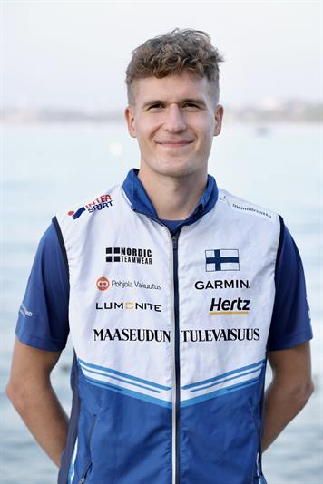
One of the runners fighting for a spot at WOC, with a great knowledge of the terrain, and a member of the Finnish National Team, Aaro Aho agreed to share his thoughts about this leg (he picked the C-BLUE route):
“First, I checked the route around to the right. It would offer really fast runnability and a safe attack to the control, but saving 25 meters of climb might not be enough to justify running that far around. Then I considered the straight options. Passing the green area via the trail and gradually getting some of the climb on the path looked tempting. Being on the right side makes the execution easier, as you can identify the highest point on top of the hill and then attack the control from the path, using the rock as an attack point and the longer re-entrant for a safe control pick. That way, I minimize risks and maintain a good offensive technique.“
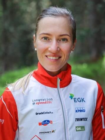
The current number 3 in the women forest world ranking, and 3 times world champion, Natalia Gemperle also was so kind to share her thoughts about this leg (he picked the B-ORANGE route):
“I will go left because I see it is shorter and there are good lines, and if you can run fast and you are strong, it is a good option. Going around it is also an option, but I believe it depends more on the individual strengths and skills of the runner. I think routes might be more or less similar in terms of time. It is up to the runner if you want to climb less because your legs are tired (then you go around), or otherwise you can go straight more slightly left or right, and perhaps using the small paths a little bit.”
We hope you enjoyed the article, and big thanks to both Aaro and Natalia for sharing their thoughts. Good luck with the selection race and… vamos Halden! 😉
Discover more from RF-COACH
Subscribe to get the latest posts sent to your email.
