
The kick-off of the World Cup Norway keeps getting closer, the selection races for most of the national teams will be this weekend, and today we are just over 2 weeks away from the first race. Therefore, we keep going with this series of Route to World Cup, and today we propose a new leg simulation very close to the arena.
SLOPE LEG AT TOREBRÅTE (#2)
One of the recurring types of legs we can expect at this world cup will be medium legs along the detailed and steep slopes of Torebråte. It is often difficult to determine the best way to get our control on these slopes, having to decide if we are going to execute the leg in a more offensive way, fighting as straight as possible; or on the contrary, look for a wider route choice in order to get better runnability and avoid getting stuck in some areas. Some aspects to consider:
- Running close to the red line offers us less distance and less climb. However, we run the risk of getting stuck if we are not precise.
- Running up or down will require a greater distance and a greater climb.
- It is important to consider the control attack, since in this type of highly detailed slopes, it is just as important to have a good plan, as it is to execute it with precision (especially near the flag).
- The leg should be considered as a small section within a complete course This means that, sometimes, working on getting the best split is not the most intelligent for the overall strategy (assumed risks, physical exhaustion due to a more demanding route,…)
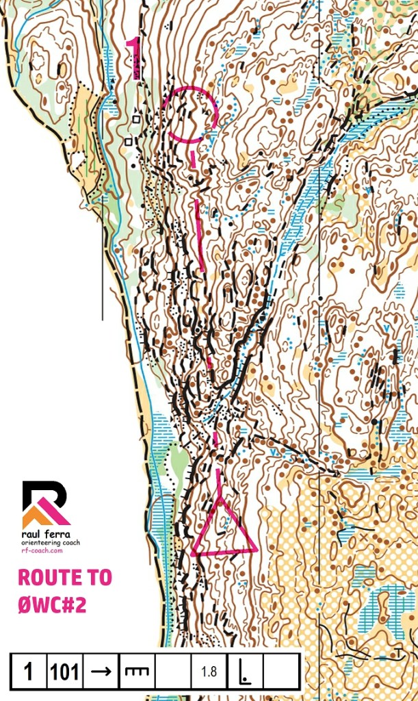
ANALYSIS OF THE ROUTE-CHOICES
If we look at the main obstacles and areas with different passability that we find on this leg, we can see how in the area most direct to the control there are several lines of impassable cliffs that we must avoid in any case. As it is a very steep slope, in the largest area of slope (to the left of the control) we see a place that is not very passable because it is steep and rocky (marked in yellow). Looking a little wider, we find lines of good runnability (path to the left and high-flat area to the right).
In order to make our route choice, we must assess 4 elements:
1) How slow is it to run through low runnability zones?
2) How fast is it to run through the high runnability zones?
3) How much more distance will it cost me to open up to look for the “green” areas?
4) How high are the risks I want to take?

After analyzing over 50 routes drawn in the previous days, we can establish up to 3 “viable” options (with few micro-variations) to execute this leg.
- Straight route (575m): It is again the most offensive option, running along the rocky slope the entire leg. It is the shortest option, but in this case, perhaps it assumes too high a risk of getting trapped and/or facing areas of lower runnability than expected. It may be a winning option, yes, but perhaps not the most sensible in this case if the risk-reward balance is taken into account.
- Right route (635m): Choosing the route on the right (in any of its 3 initial variants), will mean an extra 70 meters in order to use areas with better runnability and visibility, assuming less risk. Those 70 meters represent little more than 10% extra compared to the straight route. It seems like a safer option than the straight option, and even if it could be slightly slower (assuming the straight option is executed perfectly without getting into trouble), the runner wouldn’t drop too many seconds here.
- Left route (670m): The other alternative for the more “runner” athletes is to drop down to the path, run at maximum speed, and then attack control from below by going up the slope on its rocky ground area. It can be a viable alternative, getting the first two-thirds of the leg at high speed, but a very slow and physically hard end of the leg. It is probably the worst of the three routes, but it can be a good option for very physically powerful runners.
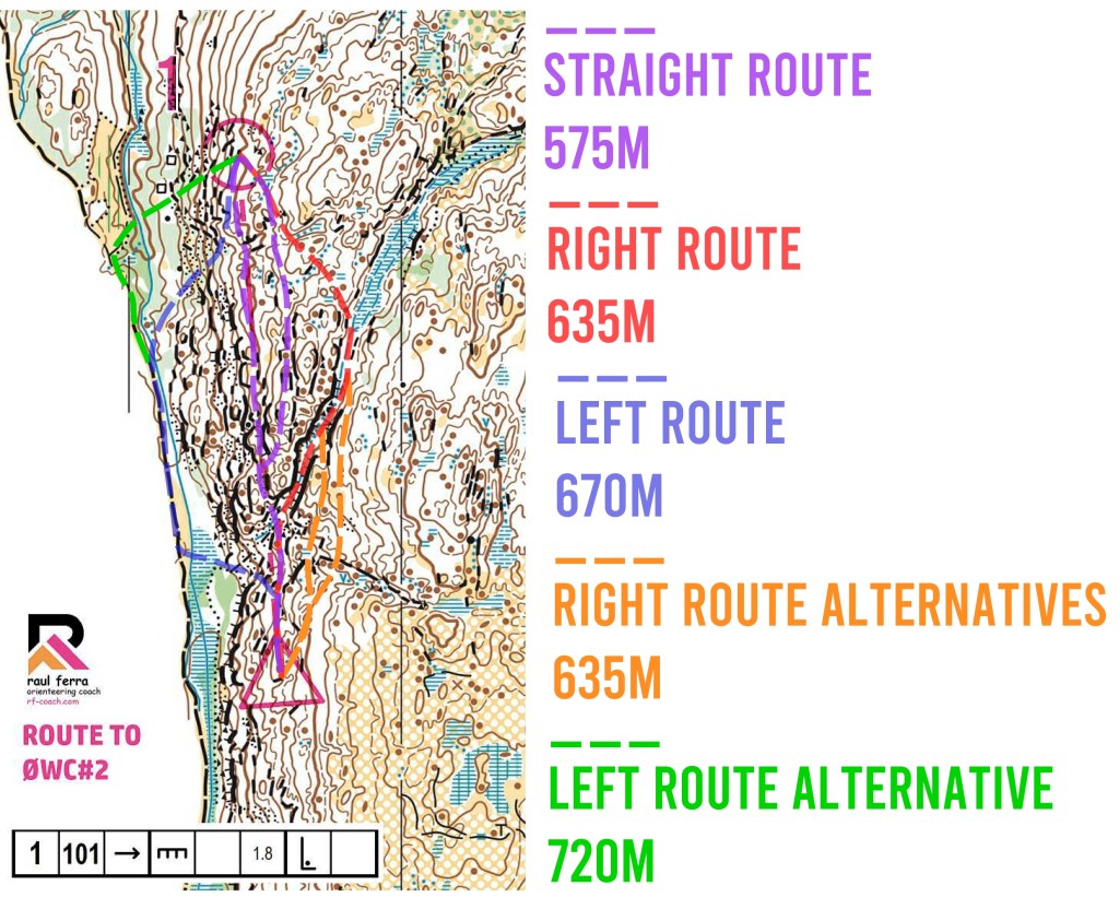

The count of the routes drawn until the publication of this article yields results where clearly the most chosen option (above 50%) is the option on the right, followed by the straight option (close to 30%), while only 17% of the participants have chosen the route on the left.
Having analyzed all of the above, I agree with the majority that the best route is the option on the right since it offers the best risk-gain balance and allows the athlete to use areas of good progression and visibility while avoiding high or rocky slopes that can make you lose the technical “flow” or waste energy unnecessarily.
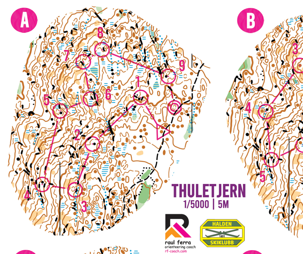
A great way to improve your running ability on this type of detailed slope, as well as understand the challenges it hides when it comes to runnability and visibility, is to perform micro-intervals on such a slope. If you’re in the area, I highly recommend the Halden SK training (available within the Easter O-Package open to all athletes) which you can purchase here: link to EOP23-08
Did you like the content? You can buy me a cup of coffee 😉
Discover more from RF-COACH
Subscribe to get the latest posts sent to your email.

2 thoughts on “Route to World Cup #2 (with analysis)”